Niederbauen Chulm HB/NW-014 28.08.2024

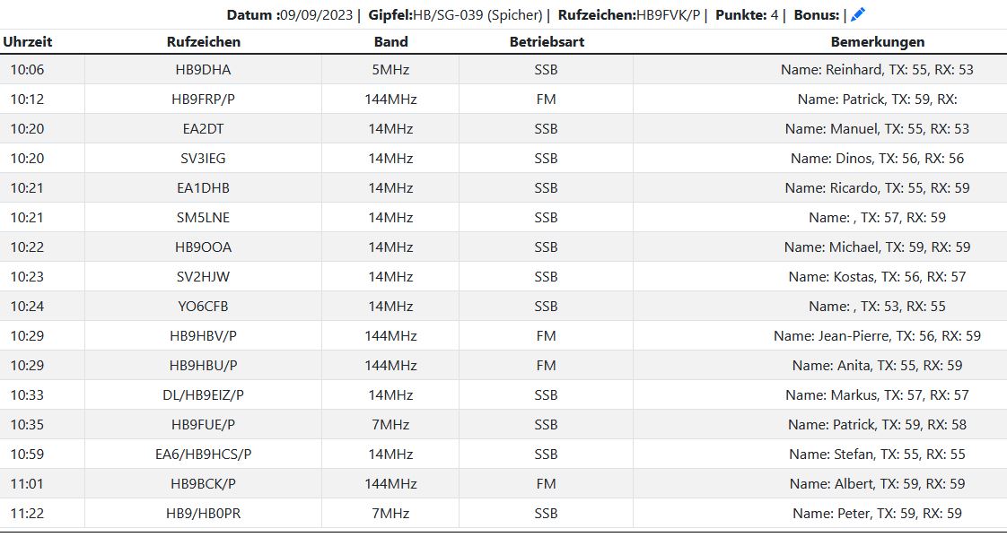
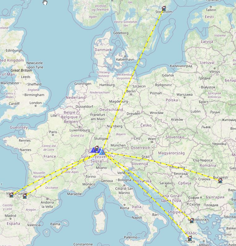
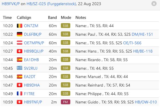
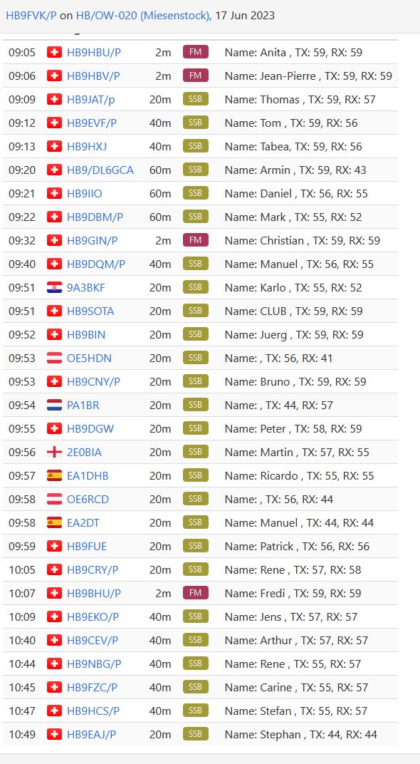
a nice day invited my to do an activation, by public transport i went to “Emmetten Post”, (unfortunately i got the wrong bus, there are two with the same number, ask the driver for the right bus). There i a cable car taking you to the start of the hike. I decided to take the longer hike for the ascent, even this one is step and no nice trail, you get rewarded with the view of Lake Uri, part of Lake Lucerne. At the top, you can see the hole Lake Lucerne, it is just stunning view from there. The summit was crowded with a lot of people, i found a small spot, where i could install myself.i Worked some stations with weak signal report, but had enough to get the point. Before the descent i had some lunch and enjoyed the view, check the pictures.


IMG20240828133258
« of 8 »


thank you for QSO, 73 de hb9fvk (ruedi)

Vogelberg HB/SO-008 25.7.2024

Time for a easy activation in the neighborhood,  i got by public transport to Passwang Pass, in the Jura Mountains. After a hike from 1 hour i got into the Activation Area.  Since i had some time, i stared with 20m getting already enough QSO go get my points. Some S2S chasing got me 4 QSO. Calling 40m resulted in two more QSO’s. I saw the Alarm from HB9GIN and thought i wait for him. Finally i got him and HB9PIM for a S2S, they needed this contact. All of a sudden i had to hurry up, to catch my bus back home. I got it.


IMG20240725093028 - Kopie
« of 10 »

thank you for QSO, 73 de hb9fvk (ruedi)

Fürstein HB/OW-016 19.07.2024

This activation was with a good friend. We went by car to Glaubenbergpass, where the hike to the Summit started.  After one hour with got over the first ridge and we finally saw the summit.  The first Part had some muddy sections, the boots from my friend were leaking so got wet socks at all. (He got new boots meanwhile). The cows on our hike have been friendly and let us pass with no problem. The last section was step one, but we did it and got the the already busy summit.

This was my first activation with my AX2 from Heinz (hb9bcb), it did not work, but i got my points. We toke the other way back to the car, passing by this lovely lake, where the farmers were harvesting hay. Later at the Restaurant we had a drink and a Mandelgipfel. The owner claims, they are the best in whole Switzerland.


IMG20240719134113
« of 16 »

thank you for QSO, 73 de hb9fvk (ruedi)

Roggenflue HB/SO-012 08.06.2024

Today is Mountain Activation Day, as the wx Forecast is not really nice, i decided to go to a closer summit. By Public Transport we went to the the Bus stop near the Summit. Here starts a short hike to the Top. A lot of Downhill Bikes where on the trail as well. My XYL toke her book with her, so i could start installing the Antenna right away.  Calls on 40m and 60m did not get me any QSO , very strange. So i concentrated for Summit2Summit. I managed even a CW QSO.  Back at the Bus stop we went to the restaurant having a small lunch and walked back to Oensingen, by passing the Neu Bechburg Castle, where a music concert was scheduled this evening.


IMG20240608135254
« of 9 »


thank you for QSO, 73 de hb9fvk (ruedi)

Hohgant/ Furggengütsch HB/BE-131 12.10.2023

I did not a lot of activation’s this year, but my main target has been to reach 250 point, still far away from a GOAT, but a milestone. As two friends asked if a join them for a hike to Hohgant/ Furggengütsch, i said immediately yes. This summit is located in the Emmental Alps and the summit is called Hoghant. We went by car and left the Car at the Parkinglot called Schwarzbach (46.762969, 7.901317), Details for this hike can be found here. For this activation i toke only a 2m Handheld with me, to be as light as possible for this heavy hike. I worked 5 swiss Stations, even two S2S. I was happy, i got my needed 8 points.


IMG20231012103838
« of 11 »


thank you for QSO, 73 de hb9fvk (ruedi)

Spicher HB/SG-039 09.09.2023

Today was the HB9SOTA Hiking Day in the Eastern Part of Switzerland. There are a lot of summits, that can be reached from Schwägalp Pass. There is even a easy one, Säntis that can be reached by a Cableway. i chose Spicher with an altitude of  1520m asl. I belive i had the longest trip to get there, more than 3 hours by public transport. The hike it self is easy with some Moreland, that was not so wet, i walk over Roots and wet grass. The rest is easy going. My main target was to get a lot of S2S. Later we met at the Restaurant and had a Drink all together.


IMG20230909114717
« of 6 »


thank you for QSO, 73 de hb9fvk (ruedi)

Furggelenstock HB/SZ-025 22.08.2023

I did not have a lot of time  for SOTA this year, but i was so hot, i wanted to go to a cooler place. Well it was cooler, but the sun was still burning like hell. By public transport you can reach Ibergeregg very easily. This pass is well known by Biker and their heavy Motorcycles. Anyway, i had to walk up to Furggelenstock and do some work up there.
During the hike i often was seeking for shadow by nearby trees. Al of sudden i was looking at a cow, that was hidden in the tree, seeking shadow as well i guess. Later i meet a young boy, explaining he is checking his cattle, there shall be 52 of them, i wished him good luck and walked on. Later i head a very loud whistle and all the cattle cam from all over the place.
at the summit there was an two Alpenzeiger, they were like a roof and one could sit underneath in the shadow. I was happy with this. On the hike back there was a sign, do not cross a herd of cows, but there was no other way back to where i started. So i walked right trough this small herd of cows. i belive they where to tired to move..


IMG20230822140516
« of 16 »

thank you for QSO, 73 de hb9fvk (ruedi)

Miesenstock HB/OW-020 17.06.2023

Today is National Summit Activation Day in HB Land, this time i selected a summit closer to my QTH as the last years summit. My Junior joined me to this activation. He picked me up in Lucern and we drove to Glaubenberg Pass. From here we started our hike to the Summit. After i setup the antenna i checked immediately for S2S, most wanted during this activation day.  As you may see, i got a lot of them.  HI. I was sitting on a brand new Bench, even the builder of the Bench showed up and took photos from an OM during an activation.  Back at the Restaurant we ate a Mandelgipfel, according the Barkeeper, the best all over Switzerland. They were still warm and tasted excellent.


IMG20230617130953
« of 14 »


thank you for QSO, 73 de hb9fvk (ruedi)

Rinderberg HB/BE-106 09.02.2023

I finally got some spare time to activate a summit and get some Bonus Points. Rinderberg is located in Zweisimmen and easy reachable by public transport. After a short walk you get to the Gondola Lift up to Rinderhorn. From the restaurant there is a short hike to the top. Get good boots, the snow was already frozen. After work i put my Crampons to get down this steep hill. Once down i got a hot coffee on the Restaurant and went back down by the Gondola Lift.


IMG20230209113129
« of 11 »

thank you for QSO, 73 de hb9fvk (ruedi)

Le Chamossaire HB/VD-020 | Chaux Ronde HB/VD-024 18.10.2022

Today i wanted to activate two summits in the Canton Vaud. It’s a french speaking area and the place where i’am going is well known for skiing. By public transport (train and bus) i got to Villars sur Ollon. Further on by a train, i arrived at Col de Bretaye, after four hour of travel. From the Station you may see on of the summits, it has a Chairlift on top of Le Chamossaire . The hike is short but step, approximately 19% positive slope. Well at the end i got to the summit and installed my gear, toke some pictures and started working the bands. Since i wanted to activate a second summit i left and walked down to the Station again to hike the second summit.


IMG_20221018_105213
« of 9 »

The first part of the hike, just follow the Service road for the Chairlift station at the Top of lower summit of Chaux Ronde 1988m.s.l.Until the season 2021-2022 there was an old Ski lift. The are building a brand new Chair Lift from Lac Noir to Chaux Ronde. I should be ready for next Winter season. Check the pictures.

The real summit has 2028 m.s.l., there is no official hike up there. Just walk as you like. Once there is a flat plateau, with enough space to setup any kind of antenna. It was fun working here, a lot of QSO’s in no time. After all it was a long day, i was twelve hours on tour. But happy with 18 more point.


IMG_20221018_124453
« of 9 »


thank you for QSO, 73 de hb9fvk (ruedi)