Our target today for my XYL and me is the Musenalper Grat. We took the easy way to get to the Top. There are two different Cable Cars. First from Niederrickenbach Station to Niederrickenbach Dorf , from here with a small Cable Car to the Summit. Once at the top, there is a short walk to the Activation Zone. All of a sudden a cool wind showed up and my XYL wanted to have a Drink in the Alpbeizli. We took a Glas of white wine and since i had some cold fingers i took a special coffee Zwetschgen Luz. A Hot coffee in a Glass, few coffee and more schnaps. They bring the coffee and put the Bottle with the schnaps on the Table, you may server your self.
After the break we walked down to Niederrickenbach Dorf and from there back home by Public Transport
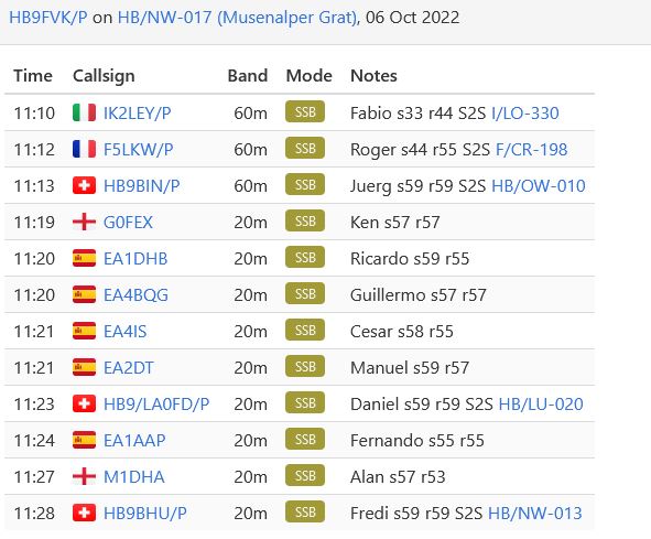
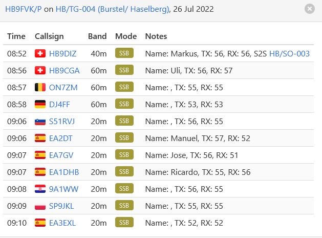
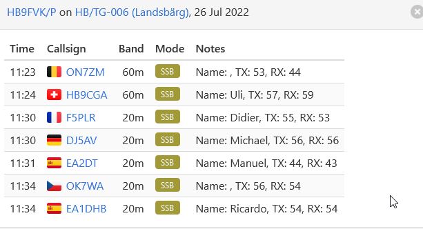
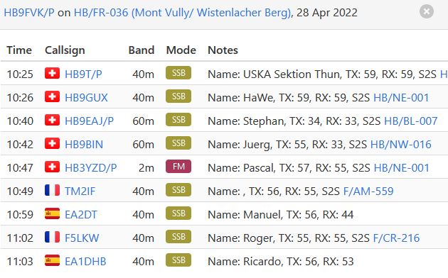
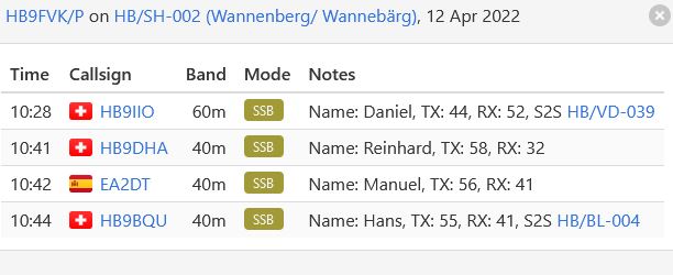
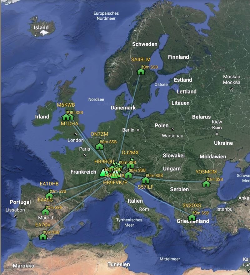
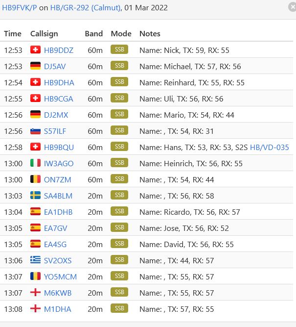
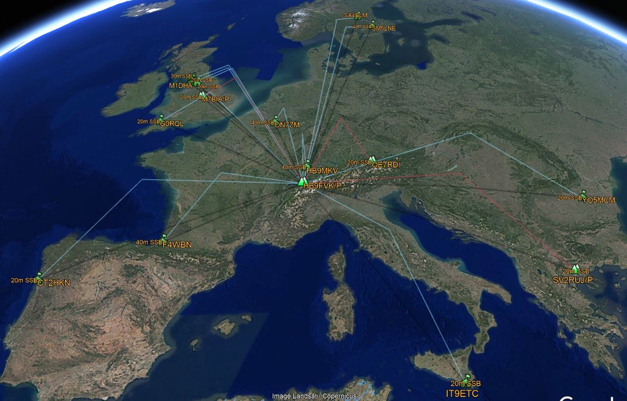
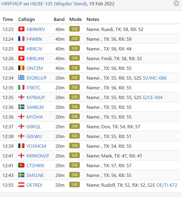
thank you for QSO, 73 de hb9fvk (ruedi)